Monday, September 26, 2022

The "Milton Banner" -- Milton, Caswell County, North Carolina

Milton Newspapers: Milton Banner

Here we have discussed Milton newspapers of the early 1800s and the editors thereof. In 1845, another such Milton newspaper was proposed: the Milton Banner. It was to be a Democratic publication, apparently to oppose the Milton Whig newspaper: the Milton Chronicle (Charles Napoleon Bonaparte Evens, editor).

Whether the Milton Banner was published requires additional research. It would have been a staunch supporter of Democratic President James Knox Polk (1845-1849), a protégé of President Andrew Jackson. 

The proposed publisher, and presumably the editor of the Milton Banner, was Barzillai Graves. This person has not been fully identified. I have three potential entries in the Caswell County Genealogy database.


The Weekly Standard (Raleigh, North Carolina), 26 February 1845

Click image to see a larger version.

Monday, September 19, 2022

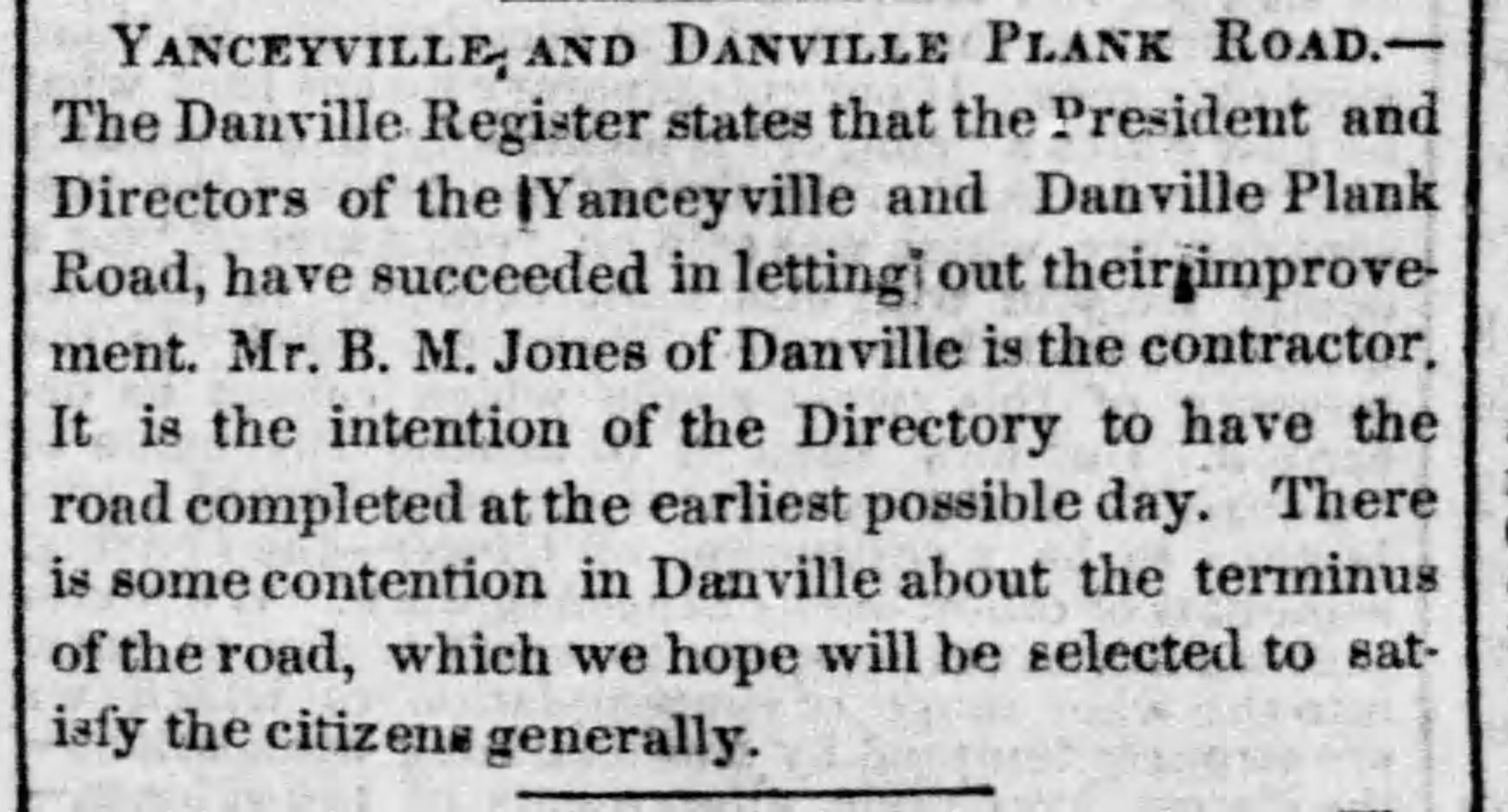
Yanceyville and Danville Plank Road


In 1852, the North Carolina General Assembly chartered the Caswell Plank Road Company. Thomas Donoho Johnston, Abisha Slade, Dr. Allen Gunn, W. B. Bowe [probably William Bradley Bowe], and John Kerr were named directors and authorized to open books in Yanceyville and elsewhere to receive subscriptions not in excess of $50,000 for the construction of a plank road from Yanceyville to some point on the Virginia line where it would meet another road leading to Danville. Shares were $50 each. Under its charter the company had power to condemn land for the road, could enter into contracts, could erect toll gates, and do a variety of other things necessary for the performance of its work. The charter specified that profits were not to exceed 25 percent a year and that the road constructed were to be not less than sixty feet wide.

Newspaper Item: Richmond Dispatch, Tuesday, 16 August 1853.

J. S. Totten became president of the company, with Thomas Donoho Johnston secretary-treasurer. William Long became one of the most important stockholders, purchasing a number of shares at different times between 1853 and 1859.

By 1855, the plank road to Danville had been located and graded to Hogan's Creek, construction having begin at the Virginia line, with about one mile planked. The route also had been surveyed from Hogan's Creek to Yanceyville.

By June 1856, the Yanceyville to Danville Plank Road was open, being one of just two interstate plank roads with which North Carolinians were involved.

This plank road between Yanceyville and Danville apparently was a financial success, with its income realized from tolls charged.

What happened to the Yanceyville-Danville plank road during the Civil War is not known. However, while maintenance may have been deferred, the road was still operating in 1868. This is evidenced by a record showing that in March 1868 J. M. Rawlins petitioned the court for compensation for repairing the bridge across Moons Creek on the plank road near Samuel S. Harrison's property.

_______________

Eventually, the plank road between Yanceyville and Danville apparently deteriorated and reverted to dirt. In 1905 a North Carolina state law observed that the roads of Caswell County were badly in need of repair and a referendum was authorized in May on a $40,000 bond issue. If approved, a highway commission of five men was to be elected by the county commissioners and under their supervision highways would be opened, graded, and improved. Provision also was made for rebuilding bridges. The proposal apparently failed.

A private law of 1909 incorporated the Caswell County Macadam Road Company to operate under the direction of S. G. Woods, B. S. Graves, F. W. Brown, R. L. Mitchelle, J. M. Hodges, and R. T. Wilson. Stock in the amount of $125,000 was authorized. The objective of the company was to construct a macadam road from Yanceyville to Danville (actually to the Virginia state line) to be operated as a toll road. B. S. Graves was president and J. P. Swanson secretary-treasurer. Some stock apparently was sold but no road built.

It may be that no Macadam road ever was built between Yanceyville and Danville, and that the next major improvement to "Old 86" came in 1926. The Caswell Messenger issue for March 4, 1926, reported that the contractors who were to build a concrete road from the Virginia line near Gatewood to Yanceyville recently had been in the county seat. Construction was expected to begin shortly, and supplies began arriving about ten days later. When this concrete road was completed is not known.

Source: Powell, William S. When the Past Refused to Die: A History of Caswell County North Carolina 1777-1977. Durham: Moore Publishing Company, 1977, pp. 491-493, 513-516.

Reference: North Carolina Plank Roads

Sunday, September 18, 2022

North Carolina Internal Improvement Convention: 1833

North Carolina Internal Improvement Convention: 1833


In 1833, a North Carolina Internal Improvement Convention was held at the Presbyterian Church in Salisbury, Rowan County, North Carolina. Many North Carolina counties sent a representative. Nathaniel Jones Palmer (c.1805-1854) represented Caswell County.

Palmer introduced three resolutions:

1. That it would be expedient to construct a railroad from the Dan River at Milton to the Yadkin River near Salisbury, passing through Caswell Court House (which became Yanceyville in 1835), Haw River, Greensboro, Salem, and Lexington.

2. That the navigation of the Roanoke from Milton to Weldon can be greatly improved commensurate with the quantity of freight the proposed railroad would send down the river.

3. That the North Carolina legislature should be encouraged to aid the Roanoke Navigation Company in improving the Roanoke River from Milton to Weldon or Blakely, the present terminating points of the Petersburg, Portsmouth, and Roanoke Railroads.

The Charlotte Journal (Charlotte, North Carolina), 2 November 1833.

_______________

Editor's Note: Of course it is the Dan River that runs past Milton, Caswell County, North Carolina, but the overall navigation system was referred to as Roanoke of which the Dan River is a tributary.

Merritt Child Killed in Caswell County, North Carolina: 1832

Merritt Child Killed: 1832

Based upon the report of the Caswell County Coroner, Thomas Gunn, the two-year-old son of Sidney Merritt was "murdered" by an enslaved "negro" woman named Amy. She was "owned" by Stephen Dodson of Milton.

Sidney Merritt was employed by Dodson as "overseer."

Amy used an axe on the child and confessed, stating: "That the devil persuaded her to kill it."

"Murder of Merritt Child." The Charlotte Journal (Charlotte, NC), 15 May 1832, reprinting an item from the Milton Spectator newspaper.

Editor's Note: The "owner" of the enslaved person Amy most likely is Stephen Lewis Dodson (1778-1852).

Jackson Meeting in Caswell County, North Carolina: 1832

Jackson Meeting in Caswell County: 1832


Andrew Jackson served as United States President 1829-1837. In April 1832, a "Jackson Meeting" (Democratic Party) was held at the Caswell County Courthouse. The purpose of the meeting of Jackson supporters was to nominate a delegate to attend the national convention at Baltimore to select a candidate for Vice President to run on the ticket with President Andrew Jackson.

Attendees included: James Rainey, Paul A. Haralson, Nathaniel J. Palmer, Calvin Graves, Quinton Anderson, John E. Brown, Col. John R. Clark, Dr. Willis M. Lea, Dr. James E. Williamson, and Col. Thomas W. Graves.

Caswell County was part of a district that included Rockingham County and Stokes County. The Caswell County meeting resolved to support Robert Galloway of Rockingham County as the district delegate to the national convention.

Source: "Jackson Meeting in Caswell County." Western Carolinian (Salisbury, North Carolina), 30 April 1832.
_______________

Editor's Note: Martin Van Buren was selected as Jackson's Vice President.

Saturday, September 17, 2022

Asa Thomas Mills Sale


Caswell County, North Carolina

Deed Book M, Page 279

Asa Thomas of Caswell County to Thomas Jeffreys of same, for $1500, 2 acres on Country Line Creek near Milton with a grist mill and two saw mills. 27 July 1802. Acknowledged in open court.

_______________

I have not found information on the purchaser, Thomas Jeffreys. However, there are two possibilities in my database:

1. Thomas Jeffreys (1769-1832), married Mildred Elizabeth Mitchell

2. Thomas Jeffreys (1796-1846), married Keziah B. Watlington

There also is a Thomas Jeffreys who married Kesiah Donoho, about whom I have little information.

Note the Thomas "Jeffrey" mentioned in the following:

One of the earliest references to the Thomas Mill is in a 1796 act of the North Carolina Legislature authorizing an inspection warehouse and the laying out of a town at the site of the warehouse. It was to be located near the mouth of the Country Line Creek at the Dan River on the property of Asa Thomas. Commissioners Thomas Jeffrey, Archibald Murphy, William Rainey, Archibald Samuel, and James Saunders were empowered to lay off thirty acres at or near the Thomas Mill into half acre lots and to establish a town to be named Milton. See When the Past Refused to Die: A History of Caswell County, North Carolina 1777-1977, William S. Powell (1977) at 100.

_______________

Newspaper Article: "Asa Thomas Mills and Property for Sale." The North-Carolina Journal (Halifax, North Carolina), 15 March 1802 

Friday, September 16, 2022

Nathaniel Jones Palmer 1849 Milton Land Grant

 Nathaniel Jones Palmer 1849 Milton Land Grant


On November 27, 1849, Nathaniel Jones Palmer (c.1805-1854) was issued a North Carolina Land Grant for 2.3 acres beginning on Broad Street in what now is downtown Milton, Caswell County, North Carolina.

Click image to see a larger version of the property description, which was down the hill on Broad Street in Milton to Country Line Creek.

Note the reference to Lots 38 and 39, which are well-documented. Remember that Broad Street in Milton generally runs east/west. The easterly property line was established by two rocks on Country Line Creek.

I find this surprising as I believed all the Milton property had been developed. Was land abandoned and reverted to the state? Why was this not part of the original Milton land lots/plats?